Brimbank's unique character has evolved over the past 200 years:
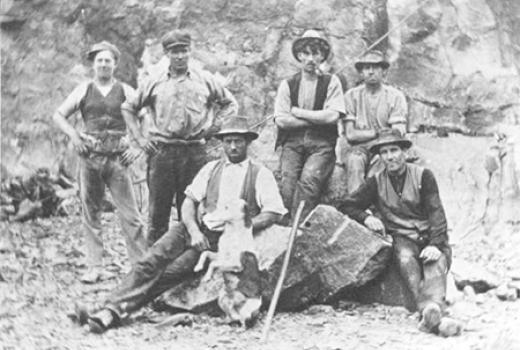
1830s - Keilor Plans became a pastoral area with European settlers establishing farms, watering their stock around the "brim of the banks" of the Maribyrnong River
1850s - Keilor township grew as it became a key stop-off point for many hopefuls travelling to the gold fields
1880s & 1890s - St Albans and Albion became some of Victoria's first planned suburbs and estates, architecturally designed to attract professionals who could travel to Melbourne city on the colony's first government railway.
Early 20th century - industry boomed in Melbourne's west with several major players based in Brimbank including the Sunshine Harvester Works, once the largest farm implements factory in the southern hemisphere.
1920s & 1930s - Keilor became a model for intensive market gardening with Victoria's first irrigation project.
1950s - multicultural Brimbank began to form with many migrants settling in the area after World War II
1970s - greater diversity in the population as the Brimbank area became home to many refugees
1994 - The City of Brimbank was formed on 15 December 1994, following the amalgamation of the former cities of Keilor and Sunshine. It is named after Brimbank Park in Keilor, which opened in 1976. The park derived its name from the early pastoral practice described above.
And the changes and growth continue....
Council has supported a number of important studies into our heritage including the:
Post-Contact Heritage Study
The Brimbank Post-Contact Heritage Study provides a history of the region from the early 1800s. It covers individual heritage places and precincts in the municipality and provides background and insights into why we consider some places an essential part of our heritage. 'Post-contact' refers to the time after the First Nations peoples had their first contact with Europeans. In Victoria, this happened around 1803 when the first white settlement was established in Port Phillip.
The study has five volumes:
- Volume 1: Environmental History (PDF 7MB)
Contains the history and historical themes of the development within the Brimbank municipality.
- Volume 2: Heritage Program and Conservation Policy (PDF 1.9MB)
Includes the methodology, summary of recommendations, statutory and non-statutory heritage provisions, conservation policy for heritage areas and a listing of all places investigated as part of the heritage study.
- Volume 3: Place Reports - Heritage Areas and Individual Places (PDF 33.5MB)
Individual site reports for places of cultural significance and heritage areas.
- Volume 4: Location Maps (PDF 7.2MB)
Site maps of individual heritage places and 11 heritage areas.
- Volume 5: Update and Review (PDF 1.6MB)
A review of the Post Contact Study 2000.
St Albans Half Houses
Council has produced the St Albans Half House Study (7.5MB) to document the history and cultural significance of the half-houses of St Albans.
What is a half-house?
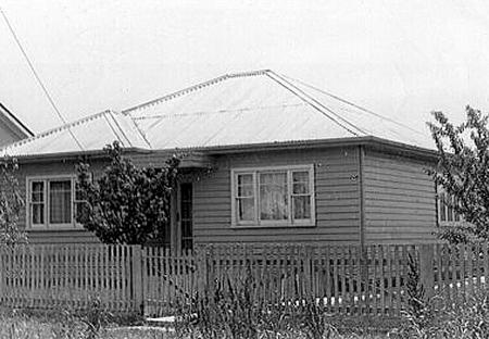
The St Albans half-houses were built around 1947-1968. They were sold as temporary homes soon after the end of World War 2 when there was a serious housing shortage in Melbourne. For the people that came to St Albans during this time they were the most affordable option to buy a home.
St Albans was previously part of the former Cities of Keilor and Sunshine. These Councils allowed construction of the half-houses on the understanding that the rest of the house would be built later.
The St Albans half-houses usually have 2 or 3 rooms and many were constructed by their owners prior to services and roads being available. The half-houses were built using locally available materials and were usually bought by newly arrived European migrants.Some half-houses are still visible today, however, in most cases the half-house is now attached to the back of a new house and is used as a kitchen, laundry or bathroom.
Some half-houses have been relocated on the block, behind or next to a new house. In this situation the half-house may be used as a shed, bungalow or storage area.

Photo Credit: Copyright Joseph Ribarow
Why are half-houses important?
The half-houses are a big part of the lives and memories of many post-war migrants and their children. They are an important part of the storey of St Albans and its diverse community. The half-houses show us the difficulties experienced by the first generation of post-war migrants in St Albans.
They are also important as a type of housing that was intended to be temporary in order to increase the supply of housing in the post-war period. The St Albans half-houses are unusual because there are now only a few known examples still in their original condition.
Other studies and resources
Brimbank Heritage Gaps Study 2014
Review and update of heritage precinct descriptions and building citations.
Heritage assessment of
- Richards Dairy - 44 Hampshire Road, Sunshine;
- Hampshire House - 233-241 Hampshire Road, Sunshine;
- Sunshine Boys Hostel - 131 Durham Road, Sunshine.
Maxweld Street, Heritage Assessment 2014 (Word 1.7MB)
Heritage Assessment of concrete houses 17-27 Maxweld Street, Ardeer.
While primarily a supporting resource for the Brimbank Planning Scheme, this database is a rich source of information on heritage places and precincts within Brimbank and includes:
- Historical information
- Photographs
- Statements of significance (where prepared)
- Physical descriptions
- Heritage overlay numbers.

